An error occured processing your request.
Please check your internet connection. If this problem persists, please disable any browser extensions that might interfere with your connection.
If you are using Avast or AVG antivirus, please disable them, they broke the http/2 internet protocol and as long as you see this error, it means they haven't really fixed their software.
Contact us if this doesn't solve this issue.
Analyze hashtags & keywords 30DayMapChallenge final
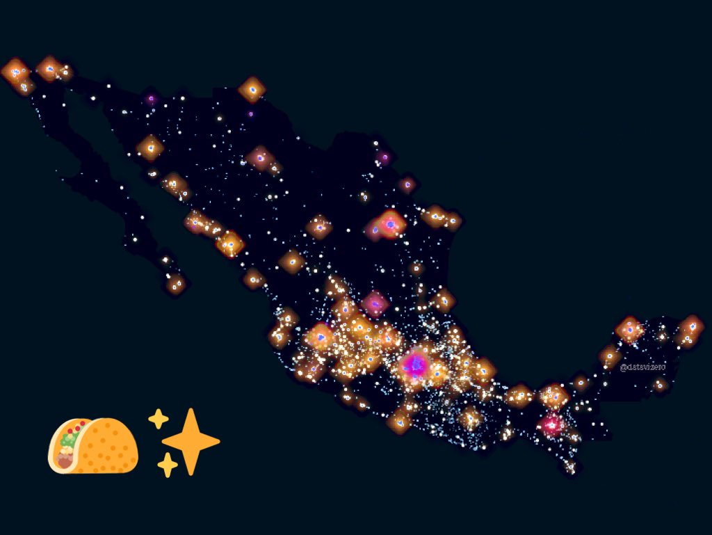
Un geógrafo finlandés lanzó un reto en Internet para crear mapas de prácticamente cualquier tema: el #30DayMapChallenge. En México abundan los tacos, los museos... y la violencia. animalpolitico.com/2019/11/reto-m…
#30DayMapChallenge
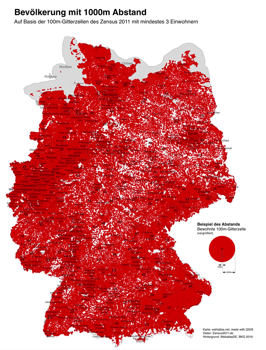
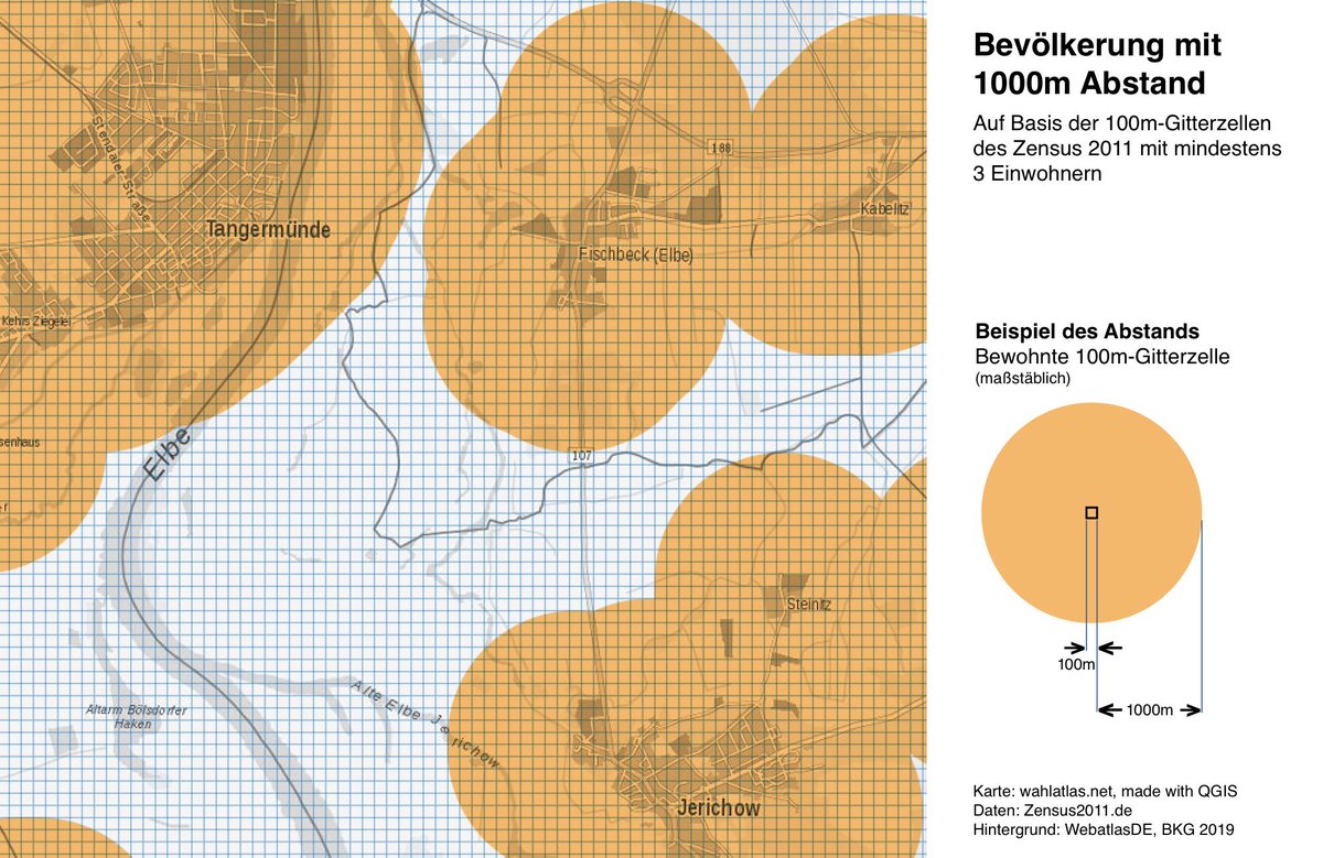
Day 17: Zones
Suppose you wanted to build something in Germany that is at least 1km away from where people live, the coloured areas are a no.
Gridded data from the 2011 #Zensus
csv-files at zensus2011.de/DE/Home/Aktuel…
WMS background from BKG, made with QGIS pic.x.com/KSDc39K4Sq
Cartographie des mobilités professionnelles en 2016 : déplacements domicile - lieu de travail à Paris, Lyon, Marseille et dans toutes les communes de France. Consultez notre carte interactive pour en savoir plus. #30DayMapChallengebit.ly/328XYBMpic.x.com/zYc8ahEamM